Basisregistratie Topografie (BRT)

brt
Created on Jun 22nd, 2022

De Basisregistratie Topografie (BRT) bestaat uit digitale topografische bestanden van heel Nederland op verschillende schaalniveaus (schaal: 1:10.000, 1:50.000, 1:100.000, 1:250.000, 1:500.000 en 1:1.000.000). Deze verzameling topografische bestanden is gratis beschikbaar als open data via het Kadaster. De BRT staat ook wel bekend als TOPNL kaart.

Links naar:

Members

TOP10NL

398.405.475 statements

TOPNL bestanden zijn objectgerichte topografische bestanden op diverse schaalniveaus. Deze bestanden maken onderdeel uit van de Basis Registratie Topografie (BRT). De bestanden zijn uniform, consistent en bovendien landsdekkend. Dit betekent dat u ze als basis kunt gebruiken voor heel Nederland. TOPNL bestanden zijn opgebouwd uit verschillende topografische elementen in het GML formaat en als Geopackage. In een geografisch informatie systeem is het mogelijk op de informatie te bekijken en te bewerken.

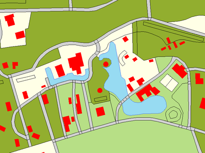
TOPNL is opgebouwd uit verschillende topografische elementen. TOP10NL past de volgende schaal toe: 1:5.000 tot en met 1:25.000.

Links naar:

A collaboration between the Dutch Cadastre (Kadaster) and the European Union Agency for Railways (ERA).

Linked data is becoming more important as an integrated way of publishing large-scale governmental datasets. Because linked data is based on open standards, it is possible to utilize the data disclosed in the these datasets across organizational as well as across national borders.

This data story presents insights from the following linked data sources:

  • ERA KG, published by ERA, contains information about railway-related objects in the EU.
  • Base Registry of Topography (BRT), published by Kadaster, contains information about geospatial objects in The Netherlands. This includes geospatial information about stations and railroads.

The goal of this data story is to explore the similarities and differences between these two linked datasets. The scope of this data story is to take two topics of interest:

  1. Information about train stations.
  2. Information about the number of tracks.

1. Stations

The ERA KG contains detailed administrative information about all train stations in the EU. However, the geospatial information about these train stations is relatively simple because only a point geometry is available.

The BRT has detailed polygons for every building in The Netherlands, including station buildings.

Here we see an opportunity to combine information from both sources to deliver a more complete picture.